Inventaires en ligne
Notice descriptive
- Cartes et plans

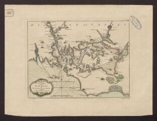
Chart of Morbihan or gulf of Vannes with the entrance of the river d'Auray / Jefferys (T.). Graveur
Cote : 1 Fi 32/1
Description :
Carte anglaise du golfe du Morbihan avec indications pour la navigation.
Année de publication : [1740-1770]
Description matérielle : 1 carte
Notes :
Carte ayant pu être datée du XVIIIe siècle grâce au nom du graveur "T. Jefferys".
Personne : Jefferys, Thomas (1719?-1771)
Type de document : Carte